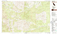
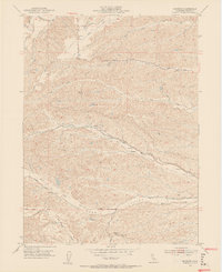
1981 Map of Chickabally Mtn
USGS Topo · Published 1981About this map
Middle Fork Cottonwood Creek and its many tributaries carve through the Northern California landscape at the boundary of Shasta and Tehama counties. This 1981 edition captures a predominantly rural and agricultural terrain, where open expanses like Wilson Field and Pentacola Field indicate established ranching or farming areas. The small settlement of Rosewood sits in the lower valley, while the higher elevations are dominated by the Bald Hills and the prominent summit of Chickabally Mtn.
Find a feature on this map
39 named features on this map. Tap any name to fly to it.
Don’t see what you’re looking for? This feature index may not catch every label — zoom into the map to look around manually.
Map Details
Editions of this 1981 Chickabally Mtn Map
2 editions found

Other maps of this area

1890 · Red Bluff
USGS Topo · 1:250,000

1894 · Red Bluff
USGS Topo · 1:250,000

1932 · Olinda
USGS Topo · 1:31,680

1935 · Olinda
USGS Topo · 1:31,680
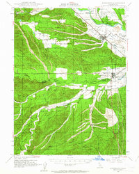
1947 · Anderson
USGS Topo · 1:62,500
1948 · Anderson
USGS Topo · 1:62,500

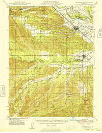
1949 · Colyear Springs
USGS Topo · 1:62,500
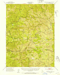
1951 · Chanchelulla Peak
USGS Topo · 1:62,500
1952 · Blossom
USGS Topo · 1:24,000
1952 · Ono
USGS Topo · 1:62,500