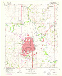
1966 Map of Chickasha
USGS Topo · Published 1976About this map
The Washita River meanders through the central landscape of Grady County, anchoring a region defined by its intersection of rail and road. The city of Chickasha serves as a major hub, its grid expanding with mid-century development and residential tracts noted during the 1975 photorevision. A dense network of local schools, including St Joseph Academy and the Oklahoma College for Liberal Arts, reflects the community’s civic priorities, while the Shannon Springs Park and Rose Hill Cemetery offer evidence of established local heritage. One of the map's most significant historical markers is the Indian Territory Boundary Line, which cuts across the western half of the quadrangle. This surveyed line serves as a reminder of the region's pre-statehood administrative history, contrasting with the modern infrastructure of the H E Bailey Toll Road Turnpike and the busy corridors of the Chicago Rock Island and Pacific railroad.
Find a feature on this map
47 named features on this map. Tap any name to fly to it.
Don’t see what you’re looking for? This feature index may not catch every label — zoom into the map to look around manually.
Map Details
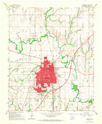
Editions of this 1966 Chickasha Map
2 editions found
Other maps of this area

1902 · Rush Springs
USGS Topo · 1:125,000

1904 · Chickasha
USGS Topo · 1:125,000

1945 · Anadarko
USGS Topo · 1:62,500

1949 · Cement
USGS Topo · 1:62,500

1949 · Rush Springs
USGS Topo · 1:62,500

1950 · Rush Springs
USGS Topo · 1:62,500

1954 · Oklahoma City
USGS Topo · 1:250,000

1955 · Lawton
USGS Topo · 1:250,000

1955 · Clinton
USGS Topo · 1:250,000

1956 · Laverty
USGS Topo · 1:24,000