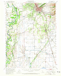
1949 Map of Chico
USGS Topo · Published 1965About this map
The Sacramento River defines the western edge of this mid-century survey, a landscape shaped by intricate waterway systems like Angel Slough and the Durham Canal. The city of Chico serves as the regional hub, home to Chico State College and industrial landmarks like the Match Factory at Barber. South of the city, the agricultural character of Butte County is evident through the gridded layout surrounding Durham and the extensive Western Canal network.
Find a feature on this map
78 named features on this map. Tap any name to fly to it.
Don’t see what you’re looking for? This feature index may not catch every label — zoom into the map to look around manually.
Map Details
Editions of this 1949 Chico Map
3 editions found
Other maps of this area

1888 · Marysville
USGS Topo · 1:125,000

1891 · Chico
USGS Topo · 1:125,000

1891 · Marysville
USGS Topo · 1:125,000

1893 · Chico
USGS Topo · 1:125,000

1894 · Marysville
USGS Topo · 1:125,000

1895 · Marysville
USGS Topo · 1:125,000

1895 · Chico
USGS Topo · 1:125,000

1904 · Vina
USGS Topo · 1:62,500

1906 · Maxwell
USGS Topo · 1:62,500

1906 · Willows
USGS Topo · 1:62,500