
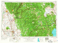
1958 Map of Chico
USGS Topo · Published 1962About this map
Beale Air Force Base stands as a significant military footprint in the lower Sacramento River valley during the late 1950s, a period when the region's agricultural roots met the growing needs of the Cold War era. The map details the complex water systems of the Sierra Nevada, tracing the intricate forks of the Feather River and the early development of reservoirs like Lake Almanor and Bucks Lake.
Find a feature on this map
167 named features on this map. Tap any name to fly to it.
Don’t see what you’re looking for? This feature index may not catch every label — zoom into the map to look around manually.
Map Details
Editions of this 1958 Chico Map
4 editions found
Other maps of this area

1886 · Honey Lake
USGS Topo · 1:250,000

1886 · Lassen Peak
USGS Topo · 1:250,000

1886 · Granite Range
USGS Topo · 1:250,000

1888 · Marysville
USGS Topo · 1:125,000

1888 · Smartsville
USGS Topo · 1:125,000

1888 · Bidwell Bar
USGS Topo · 1:125,000

1889 · Pyramid Peak
USGS Topo · 1:125,000

1889 · Markleeville
USGS Topo · 1:125,000

1890 · Red Bluff
USGS Topo · 1:250,000

1890 · Sierraville
USGS Topo · 1:125,000