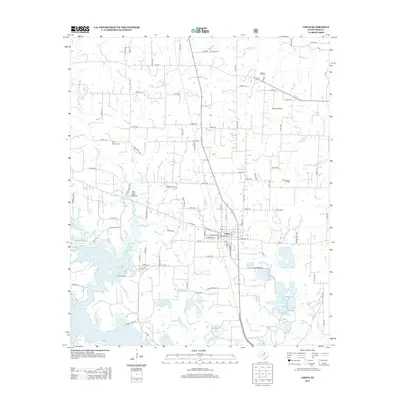
2013 Map of Chico
USGS Topo · Published 2013About this map
The settlement of Chico anchors this 2013 survey of Wise County, where the landscape transitions from established energy production to the recreational waters of Lake Bridgeport. The intricate shoreline of the lake and its neighboring Peach Hill Lake dominate the southern portion of the map, fed by a network of drainage systems including Village Cr and Dry Cr. Evidence of the region’s economic history is scattered throughout the area in the form of the Alvord Oil Field and Miles Jackson Oil Field, while the Richey Airfield suggests modern local transport.
Find a feature on this map
91 named features on this map. Tap any name to fly to it.
Don’t see what you’re looking for? This feature index may not catch every label — zoom into the map to look around manually.
Map Details
Editions of this 2013 Chico Map
This is the sole edition of this map. No revisions or reprints were ever made.
Other maps of this area

1930 · Boyd
USGS Topo · 1:62,500

1954 · Sherman
USGS Topo · 1:250,000

1958 · Sherman
USGS Topo · 1:250,000

1960 · Bridgeport West
USGS Topo · 1:24,000

1960 · Bridgeport East
USGS Topo · 1:24,000

1960 · Wizard Wells
USGS Topo · 1:24,000

1961 · Selma
USGS Topo · 1:24,000

1961 · Alvord
USGS Topo · 1:24,000

1961 · Sunset
USGS Topo · 1:24,000
1961 · Smyrna
USGS Topo · 1:24,000