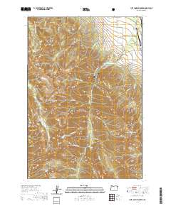
2020 Map of Chief Joseph Mountain
USGS Topo · Published 2020About this map
Chief Joseph Mtn and the surrounding high country of the Wallowa National Forest define this 2020 study of the Wallowa Mountains. The landscape is marked by sharp peaks like Ruby Peak and Sawtooth Peak, which overlook deep glacial valleys carved by Hurricane Cr and Silver Cr. Near the northeast corner, the terrain transitions into the Alder Slope, where the agriculture-driven economy is supported by gravity-fed irrigation systems such as the Consolidated Ditch and Hurricane Ditch.
Find a feature on this map
69 named features on this map. Tap any name to fly to it.
Don’t see what you’re looking for? This feature index may not catch every label — zoom into the map to look around manually.
Map Details
Editions of this 2020 Chief Joseph Mountain Map
This is the sole edition of this map. No revisions or reprints were ever made.
Other maps of this area

1954 · Cornucopia
USGS Topo · 1:62,500

1954 · Eagle Cap
USGS Topo · 1:62,500

1955 · Grangeville
USGS Topo · 1:250,000

1957 · Enterprise
USGS Topo · 1:62,500

1957 · Joseph
USGS Topo · 1:62,500

1959 · Grangeville
USGS Topo · 1:250,000

1986 · Enterprise
USGS Topo · 1:100,000

1990 · Lostine
USGS Topo · 1:24,000

1990 · Chief Joseph Mtn
USGS Topo · 1:24,000
1990 · Eagle Cap
USGS Topo · 1:24,000