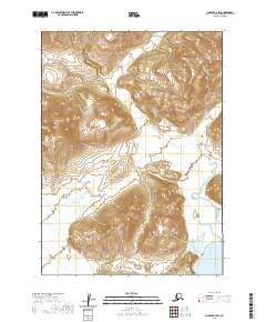
2020 Map of Chignik A-3 SW
USGS Topo · Published 2020About this map
Aleutian Range topography dominates this remote Alaskan landscape within the Lake and Peninsula borough. The 2020 survey documents the complex glacial and volcanic landforms of the region, emphasizing the dramatic elevation changes and sharp ridgelines typical of the peninsula's spine. In the southern corner of the sheet, the waters of Ivan Bay meet the coastline, providing a critical geographic anchor for the surrounding wilderness. The map is primarily a study of natural relief and hydrography, showing a terrain largely defined by its absence of permanent infrastructure, roads, or settlements. The PLSS grid markings, including t48s r62w and t47s r61w, provide the only administrative framework across these mountainous reaches.
Find a feature on this map
6 named features on this map. Tap any name to fly to it.
Don’t see what you’re looking for? This feature index may not catch every label — zoom into the map to look around manually.
Map Details
Editions of this 2020 Chignik A-3 SW Map
This is the sole edition of this map. No revisions or reprints were ever made.
Other maps of this area

1951 · Stepovak Bay
USGS Topo · 1:250,000

1963 · Chignik A-4
USGS Topo · 1:63,360

1963 · Stepovak Bay D-4
USGS Topo · 1:63,360

1963 · Chignik A-3
USGS Topo · 1:63,360

1963 · Chignik
USGS Topo · 1:250,000
1963 · Stepovak Bay D-3
USGS Topo · 1:63,360

1963 · Stepovak Bay
USGS Topo · 1:250,000

1969 · Stepovak Bay
USGS Topo · 1:250,000
2020 · Stepovak Bay D-4 NE
USGS Topo · 1:25,000
2020 · Chignik A-3 NW
USGS Topo · 1:25,000