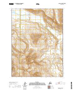
2020 Map of Chignik A-6 SE
USGS Topo · Published 2020About this map
Mt Kupreanof dominates the southern landscape of this 2020 survey, rising as a prominent peak within the Aleutian Range. This terrain is characterized by steep elevation changes and the glacial activity typical of the Alaska Peninsula. The northern portion of the sheet is defined by the winding course of the Sandy River, which meanders through the drainages of the Lake and Peninsula Borough. The map captures a largely untouched wilderness area where the boundary between the Aleutians East and Lake and Peninsula boroughs meets among high ridges and river valleys. The land remains primarily defined by its natural water systems and geological formations, with no established roads or settlements printed on the sheet, reflecting the remote nature of this part of the peninsula.
Find a feature on this map
8 named features on this map. Tap any name to fly to it.
Don’t see what you’re looking for? This feature index may not catch every label — zoom into the map to look around manually.
Map Details
Editions of this 2020 Chignik A-6 SE Map
This is the sole edition of this map. No revisions or reprints were ever made.
Other maps of this area

1951 · Stepovak Bay
USGS Topo · 1:250,000

1963 · Chignik A-6
USGS Topo · 1:63,360

1963 · Chignik A-5
USGS Topo · 1:63,360

1963 · Stepovak Bay D-6
USGS Topo · 1:63,360

1963 · Stepovak Bay D-5
USGS Topo · 1:63,360

1963 · Chignik
USGS Topo · 1:250,000

1963 · Stepovak Bay
USGS Topo · 1:250,000

1969 · Stepovak Bay
USGS Topo · 1:250,000
2020 · Stepovak Bay D-6 NW
USGS Topo · 1:25,000
2020 · Chignik A-5 SW
USGS Topo · 1:25,000