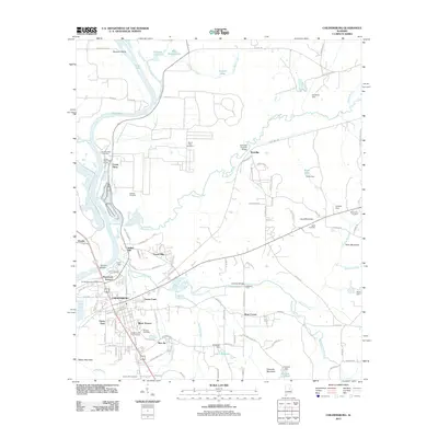
2011 Map of Childersburg
USGS Topo · Published 2011About this map
Talladega Creek winds through the heart of this Talladega County landscape, where the landmark Kymulga Covered Bridge serves as a bridge between the area's agricultural past and its modern topography. The settlement of Childersburg stands as a central hub, surrounded by residential developments like Indian Hill, Minor Terrace, and Bon Air. To the northwest, the industrial presence of Coosa Pines sits adjacent to the Coosa River Golf Course and the waters of Lay Lake.
Find a feature on this map
120 named features on this map. Tap any name to fly to it.
Don’t see what you’re looking for? This feature index may not catch every label — zoom into the map to look around manually.
Map Details
Editions of this 2011 Childersburg Map
This is the sole edition of this map. No revisions or reprints were ever made.
Other maps of this area

1890 · Talladega
USGS Topo · 1:125,000

1892 · Talladega
USGS Topo · 1:125,000

1915 · Gantts Quarry
USGS Topo · 1:48,000

1917 · Gantts Quarry
USGS Topo · 1:62,500

1943 · Talladega
USGS Topo · 1:62,500

1944 · Goodwater
USGS Topo · 1:62,500

1946 · Talladega
USGS Topo · 1:62,500

1947 · Goodwater
USGS Topo · 1:62,500

1951 · Vincent
USGS Topo · 1:24,000

1951 · Laniers
USGS Topo · 1:24,000