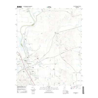
2014 Map of Childersburg
USGS Topo · Published 2014About this map
Childersburg and its surrounding neighborhoods anchor this 2014 survey along the Coosa River, where residential expansion meets the industrial footprint of Coosa Pines. The map captures a high degree of local detail in the subdivided areas of Pinewood Terrace, Minor Terrace, and Grove Park, contrasted with the rural expanses to the east. A notable highlight is the Kymulga Covered Bridge over Talladega Cr, a significant historical landmark near the settlement of Kymulga.
Find a feature on this map
123 named features on this map. Tap any name to fly to it.
Don’t see what you’re looking for? This feature index may not catch every label — zoom into the map to look around manually.
Map Details
Editions of this 2014 Childersburg Map
This is the sole edition of this map. No revisions or reprints were ever made.
Other maps of this area

1890 · Talladega
USGS Topo · 1:125,000

1892 · Talladega
USGS Topo · 1:125,000

1915 · Gantts Quarry
USGS Topo · 1:48,000

1917 · Gantts Quarry
USGS Topo · 1:62,500

1943 · Talladega
USGS Topo · 1:62,500

1944 · Goodwater
USGS Topo · 1:62,500

1946 · Talladega
USGS Topo · 1:62,500

1947 · Goodwater
USGS Topo · 1:62,500

1951 · Vincent
USGS Topo · 1:24,000

1951 · Laniers
USGS Topo · 1:24,000