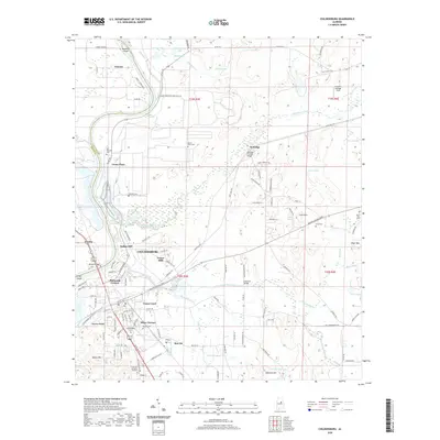
2020 Map of Childersburg
USGS Topo · Published 2020About this map
The historical Kymulga Covered Bridge spans Talladega Creek in this modern topographic survey, anchoring a landscape where industrial infrastructure and rural heritage meet. In Childersburg, residential expansion is evidenced by neighborhoods like Forest Hills, Pinewood Terrace, and Minor Terrace, while the industrial legacy of Coosa Pines and the Coosa Industrial Park remains prominent along the Coosa River corridor. The map is a valuable resource for genealogists, documenting numerous local burial grounds including Old Reynolds Cem, Mount Olive Cem, and the Green Hill Memorial Gardens.
Find a feature on this map
129 named features on this map. Tap any name to fly to it.
Don’t see what you’re looking for? This feature index may not catch every label — zoom into the map to look around manually.
Map Details
Editions of this 2020 Childersburg Map
This is the sole edition of this map. No revisions or reprints were ever made.
Other maps of this area

1890 · Talladega
USGS Topo · 1:125,000

1892 · Talladega
USGS Topo · 1:125,000

1915 · Gantts Quarry
USGS Topo · 1:48,000

1917 · Gantts Quarry
USGS Topo · 1:62,500

1943 · Talladega
USGS Topo · 1:62,500

1944 · Goodwater
USGS Topo · 1:62,500

1946 · Talladega
USGS Topo · 1:62,500

1947 · Goodwater
USGS Topo · 1:62,500

1951 · Vincent
USGS Topo · 1:24,000

1951 · Laniers
USGS Topo · 1:24,000