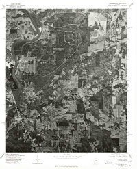
1975 Map of Childersburg
USGS Topo · Published 1977About this map
Childersburg serves as the focal point of this 1970s orthophotograph, where the industrial and residential grid of the town meets the winding course of the Coosa River. The imagery, produced by the Geological Survey in cooperation with the Soil Conservation Service, provides a detailed visual record of the mid-century land use patterns in this part of Talladega County. The large expanse of Lay Lake dominates the northwest, reflecting the importance of water management and industrial development to the local economy during this era. Unlike traditional topographic maps, this aerial perspective allows researchers to see the actual density of timber, the precise boundaries of cleared agricultural fields, and the specific layout of industrial facilities that supported the community at the time the photograph was taken in late 1975.
Find a feature on this map
3 named features on this map. Tap any name to fly to it.
Don’t see what you’re looking for? This feature index may not catch every label — zoom into the map to look around manually.
Map Details
Editions of this 1975 Childersburg Map
This is the sole edition of this map. No revisions or reprints were ever made.
Other maps of this area

1890 · Talladega
USGS Topo · 1:125,000

1892 · Talladega
USGS Topo · 1:125,000

1915 · Gantts Quarry
USGS Topo · 1:48,000

1917 · Gantts Quarry
USGS Topo · 1:62,500

1943 · Talladega
USGS Topo · 1:62,500

1944 · Goodwater
USGS Topo · 1:62,500

1946 · Talladega
USGS Topo · 1:62,500

1947 · Goodwater
USGS Topo · 1:62,500

1951 · Vincent
USGS Topo · 1:24,000

1951 · Laniers
USGS Topo · 1:24,000