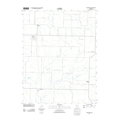
2011 Map of Chilhowee
USGS Topo · Published 2011About this map
Chilhowee and its predecessor, Old Chilhowee, anchor this portion of Johnson County, Missouri, during the early twenty-first century. The landscape is defined by a dense grid of rural roads and the drainage networks of Honey Creek and its branches, which carve through the agricultural terrain. The distinct locations of the two Chilhowee sites reflect a common pattern of shifted settlement centers, often influenced by early transportation routes and regional development.
Find a feature on this map
28 named features on this map. Tap any name to fly to it.
Don’t see what you’re looking for? This feature index may not catch every label — zoom into the map to look around manually.
Map Details
Editions of this 2011 Chilhowee Map
This is the sole edition of this map. No revisions or reprints were ever made.
Other maps of this area

1885 · Warrensburg
USGS Topo · 1:125,000

1887 · Clinton
USGS Topo · 1:125,000

1887 · Warrensburg
USGS Topo · 1:125,000

1894 · Warrensburg
USGS Topo · 1:125,000

1894 · Clinton
USGS Topo · 1:125,000

1947 · Jefferson City
USGS Topo · 1:250,000

1953 · Hartwell
USGS Topo · 1:24,000

1953 · Calhoun West
USGS Topo · 1:24,000
1953 · Clinton North
USGS Topo · 1:24,000

1954 · Jefferson City
USGS Topo · 1:250,000