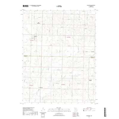
2017 Map of Chilhowee
USGS Topo · Published 2017About this map
Chilhowee serves as the primary hub on this Missouri quadrangle, situated at the intersection of several regional roads and adjacent to the historical site of Old Chilhowee. The landscape is characterized by the winding tributaries of the Hogan Fork and Honey Cr, which carve a rolling topography through the rural borderlands of Johnson and Henry counties. In the southern reaches, the small settlement of Petersburg and the Carrsville Cemetery provide evidence of long-established local communities centered around agriculture and family ties. To the east, the prominent terrain feature of Shawnee Mound rises near the community of Post Oak, overlooking the headwaters of the West Fork Tebo Creek. This survey captures a moment in the modern era where century-old place names and family cemeteries like Providence Cemetery persist alongside a dense network of modern county roads.
Find a feature on this map
62 named features on this map. Tap any name to fly to it.
Don’t see what you’re looking for? This feature index may not catch every label — zoom into the map to look around manually.
Map Details
Editions of this 2017 Chilhowee Map
This is the sole edition of this map. No revisions or reprints were ever made.
Other maps of this area

1885 · Warrensburg
USGS Topo · 1:125,000

1887 · Clinton
USGS Topo · 1:125,000

1887 · Warrensburg
USGS Topo · 1:125,000

1894 · Warrensburg
USGS Topo · 1:125,000

1894 · Clinton
USGS Topo · 1:125,000

1947 · Jefferson City
USGS Topo · 1:250,000

1953 · Hartwell
USGS Topo · 1:24,000

1953 · Calhoun West
USGS Topo · 1:24,000
1953 · Clinton North
USGS Topo · 1:24,000

1954 · Jefferson City
USGS Topo · 1:250,000