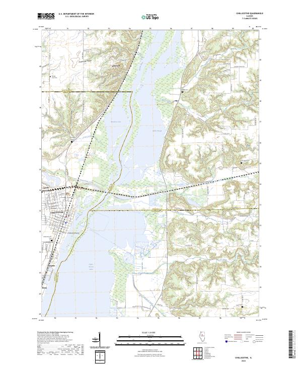
2024 Map of Chillicothe
USGS Topo · Published 2024About this map
The Illinois River dominates this landscape, widening into Upper Peoria Lake and Babb Slough as it flows past the established waterfront of Chillicothe. The river network is complex, featuring Chillicothe Island and numerous tributaries such as Senaehwine Creek and Crow Creek that cut through the bluffs. For genealogists and local historians, the sheet is rich with family-named landmarks and burial sites, including Old Salem Cem, Imhoff Cem, and the Yankee Lane Cem located near the northern settlements.
Find a feature on this map
83 named features on this map. Tap any name to fly to it.
Don’t see what you’re looking for? This feature index may not catch every label — zoom into the map to look around manually.
Map Details
Editions of this 2024 Chillicothe Map
This is the sole edition of this map. No revisions or reprints were ever made.
Other maps of this area

1893 · Lacon
USGS Topo · 1:62,500

1893 · Metamora
USGS Topo · 1:62,500

1893 · Dunlap
USGS Topo · 1:62,500

1898 · Dunlap
USGS Topo · 1:62,500

1932 · Dunlap
USGS Topo · 1:62,500

1933 · Dunlap
USGS Topo · 1:62,500

1933 · Lacon
USGS Topo · 1:62,500

1933 · Camp Grove
USGS Topo · 1:48,000

1937 · Metamora
USGS Topo · 1:62,500

1937 · Dunlap
USGS Topo · 1:62,500