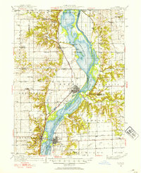
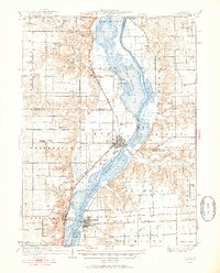
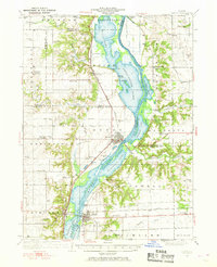
1933 Map of Lacon
USGS Topo · Published 1933About this map
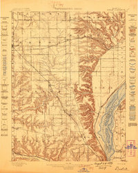
The Illinois River corridor dominates this 1933 survey, defining a landscape of expansive backwater lakes and riverfront settlements in Marshall Co and Putnam counties. The eastern bank is anchored by Lacon, where the Alton railroad terminates near the river, while across the water at Sparland, the Chicago Rock Island and Pacific tracks follow the western shore. This era represents a complex aquatic ecosystem of sloughs and basins like Senachwine Lake, Sawmill Lake, and Goose Lake, which provided both natural resources and navigation challenges before modern channelization.
Find a feature on this map
75 named features on this map. Tap any name to fly to it.
Don’t see what you’re looking for? This feature index may not catch every label — zoom into the map to look around manually.
Map Details
Editions of this 1933 Lacon Map
3 editions found
Other maps of this area

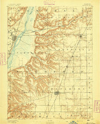
1893 · Lacon
USGS Topo · 1:62,500

1893 · Hennepin
USGS Topo · 1:62,500
1893 · Metamora
USGS Topo · 1:62,500

1893 · Dunlap
USGS Topo · 1:62,500

1893 · Lasalle
USGS Topo · 1:62,500
1898 · Dunlap
USGS Topo · 1:62,500

1909 · Hennepin
USGS Topo · 1:62,500

1911 · La Salle
USGS Topo · 1:62,500

1911 · Hennepin
USGS Topo · 1:62,500

1913 · La Salle
USGS Topo · 1:62,500