
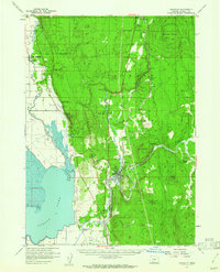
1957 Map of Chiloquin
USGS Topo · Published 1961About this map
Chiloquin sits at the confluence of the Sprague River and Williamson River, serving as a central hub for the Klamath Indian Reservation in the late 1950s. The landscape is defined by the sharp transition from the wetlands of Agency Lake and the Upper Klamath National Wildlife Refuge to the high timbered country of Solomon Butte and Sun Mtn. This era shows a community deeply tied to both the land and the rail, with the Southern Pacific railroad threading through the river valleys to reach timber and agricultural points like Braymill and Kirk.
Find a feature on this map
52 named features on this map. Tap any name to fly to it.
Don’t see what you’re looking for? This feature index may not catch every label — zoom into the map to look around manually.
Map Details
Editions of this 1957 Chiloquin Map
3 editions found

Other maps of this area

1889 · Klamath
USGS Topo · 1:250,000

1891 · Ashland
USGS Topo · 1:250,000

1893 · Ashland
USGS Topo · 1:250,000

1894 · Klamath
USGS Topo · 1:250,000

1897 · Ashland
USGS Topo · 1:250,000

1955 · Lake O' Woods
USGS Topo · 1:62,500

1955 · Pelican Butte
USGS Topo · 1:62,500

1955 · Klamath Falls
USGS Topo · 1:250,000

1955 · Medford
USGS Topo · 1:250,000

1956 · Calimus Butte
USGS Topo · 1:62,500