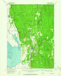
1957 Map of Chiloquin
USGS Topo · Published 1962About this map
The Klamath Indian Reservation boundary defines much of this landscape, where the confluence of the Williamson River and Sprague River serves as a geographic anchor at Chiloquin. The mid-century era is preserved here through a dense network of infrastructure supporting the regional timber and water economies, including the Southern Pacific railroad and irrigation features like Sevenmile Canal. Significant cultural landmarks include the Williamson River Mission and Wilson Cem, providing critical touchpoints for family history research.
Find a feature on this map
55 named features on this map. Tap any name to fly to it.
Don’t see what you’re looking for? This feature index may not catch every label — zoom into the map to look around manually.
Map Details
Editions of this 1957 Chiloquin Map
3 editions found


Other maps of this area

1889 · Klamath
USGS Topo · 1:250,000

1891 · Ashland
USGS Topo · 1:250,000

1893 · Ashland
USGS Topo · 1:250,000

1894 · Klamath
USGS Topo · 1:250,000

1897 · Ashland
USGS Topo · 1:250,000

1955 · Lake O' Woods
USGS Topo · 1:62,500

1955 · Pelican Butte
USGS Topo · 1:62,500

1955 · Klamath Falls
USGS Topo · 1:250,000

1955 · Medford
USGS Topo · 1:250,000

1956 · Calimus Butte
USGS Topo · 1:62,500