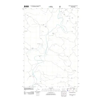
2011 Map of Chimney Butte
USGS Topo · Published 2011About this map
Little Missouri River meanders through this western North Dakota landscape, carving a valley defined by deep-set drainages and remote cattle operations. The map documents a traditional ranching economy represented by numerous named holdings, including the Maltese Cross Ranch, Custer Trail Ranch, and McCutchen Ranch. These properties are tied to the local geography by a network of rural routes like W River Rd and Garner Creek Rd, which navigate the broken ground near Chimney Butte. Beyond the agricultural landscape, the presence of the Medora Oil Field in the northeast quadrant signals the intersection of historic land use with modern energy extraction. The terrain is further dissected by numerous named waterways such as Tepee Creek, Merrifield Creek, and Dantz Creek, providing a detailed look at the drainage patterns that have shaped this portion of the Badlands.
Find a feature on this map
46 named features on this map. Tap any name to fly to it.
Don’t see what you’re looking for? This feature index may not catch every label — zoom into the map to look around manually.
Map Details
Editions of this 2011 Chimney Butte Map
This is the sole edition of this map. No revisions or reprints were ever made.
Other maps of this area

1953 · Dickinson
USGS Topo · 1:250,000

1957 · Dickinson
USGS Topo · 1:250,000

1961 · Rocky Ridge
USGS Topo · 1:62,500

1962 · Tracy Mountain
USGS Topo · 1:24,000

1962 · Fryburg NW
USGS Topo · 1:24,000

1970 · Medora
USGS Topo · 1:24,000
1979 · Buffalo Gap Campground
USGS Topo · 1:24,000
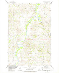
1979 · Chimney Butte
USGS Topo · 1:24,000

1979 · Square Butte
USGS Topo · 1:24,000

1979 · Bullion Butte
USGS Topo · 1:24,000