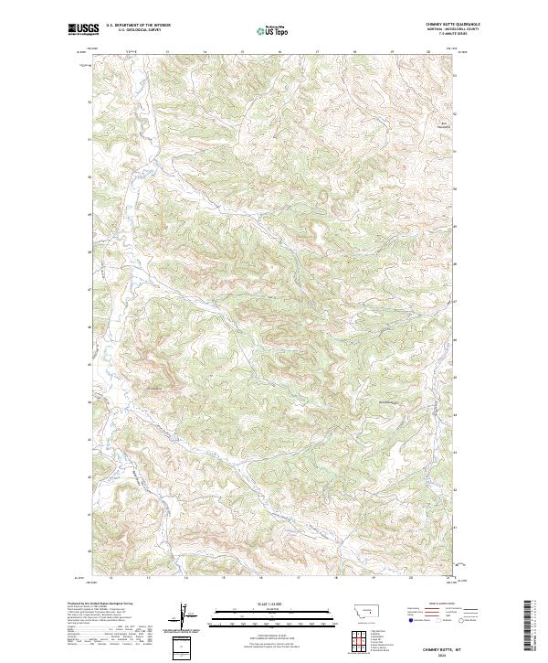
2024 Map of Chimney Butte
USGS Topo · Published 2024About this map
The Bull Mountains dominate this high-plains landscape in Musselshell County, where sharp topographic relief is defined by a network of seasonal drainages and coulees. The prominent landmark of Chimney Butte rises above the surrounding terrain, overlooking the winding paths of Fattig Creek and its southern branches. This area of Montana is characterized by a sparse, ranch-oriented infrastructure where local movement follows the natural contours of the land, as seen with Carters Coulee Rd threading through the valley of Carters Coulee. The presence of a named Spring in the southern portion of the quadrangle highlights the importance of reliable water sources in this semi-arid environment. Further west, Teepee Coulee provides additional drainage into the creek system, while Fishel Creek cuts through the eastern slopes of the mountains.
Find a feature on this map
17 named features on this map. Tap any name to fly to it.
Don’t see what you’re looking for? This feature index may not catch every label — zoom into the map to look around manually.
Map Details
Editions of this 2024 Chimney Butte Map
This is the sole edition of this map. No revisions or reprints were ever made.
Other maps of this area

1954 · Roundup
USGS Topo · 1:250,000

1958 · Roundup
USGS Topo · 1:250,000

1963 · Musselshell
USGS Topo · 1:24,000

1963 · Delphia
USGS Topo · 1:24,000

1979 · Roundup
USGS Topo · 1:100,000

1979 · Corey Flat
USGS Topo · 1:24,000

1979 · Gage NE
USGS Topo · 1:24,000

1979 · Chimney Butte
USGS Topo · 1:24,000
1980 · Steamboat Butte
USGS Topo · 1:24,000

1980 · Cherry Spring
USGS Topo · 1:24,000