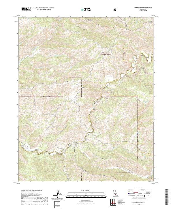
2021 Map of Chimney Canyon
USGS Topo · Published 2021About this map
Los Padres National Forest encompasses much of this interior landscape, where the rugged drainages of the Sierra Madre Mountains meet the high ridges of the California Coast Ranges. The southern portion of the map is defined by the Cuyama River, which serves as a natural boundary between San Luis Obispo and Santa Barbara counties. Evidence of human passage is found in the extensive network of fire roads and backcountry trails, such as Shaw Ridge Rd and the Buckhorn Ridge Trl, which navigate the steep elevations between Shell Peak and the deep incisions of Chimney Canyon. The presence of reliable water sources like Buck Cove Spring and Willow Spring indicates the critical points of relief in this arid terrain, while names like Charlie Valley and Pine Canyon hint at the local topography that once supported ranching or early homesteading efforts.
Find a feature on this map
43 named features on this map. Tap any name to fly to it.
Don’t see what you’re looking for? This feature index may not catch every label — zoom into the map to look around manually.
Map Details
Editions of this 2021 Chimney Canyon Map
This is the sole edition of this map. No revisions or reprints were ever made.
Other maps of this area

1905 · Lompoc
USGS Topo · 1:125,000

1922 · Nipomo
USGS Topo · 1:62,500

1937 · Branch Mtn
USGS Topo · 1:48,000

1942 · Lompoc
USGS Topo · 1:125,000

1942 · Santa Maria
USGS Topo · 1:62,500

1942 · Branch Mountain
USGS Topo · 1:62,500

1942 · Tepusquet Peak
USGS Topo · 1:62,500

1943 · Tepusquet Peak
USGS Topo · 1:62,500

1943 · Lompoc
USGS Topo · 1:125,000
1947 · Los Coches Mtn
USGS Topo · 1:24,000