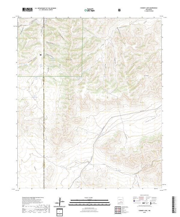
2023 Map of Chimney Lake
USGS Topo · Published 2023About this map
Lincoln National Forest land dominates this high-altitude landscape along the border of Otero and Chaves counties. The terrain is defined by a series of significant canyons including Dead Horse Canyon, Chimney Canyon, and Twomile Canyon, which cut through the high ridges. Prominent elevations such as One Tree Peak and Chimney Peak serve as landmarks for the area. Water management for livestock or wildlife is evident through the naming of numerous man-made tanks, including Pine Tank, Bar-X Tank, and Long Canyon Tank. Transport through the area relies on a network of backcountry roads like Champion Canyon Rd and Mc Casland Rd, which navigate the complex system of draws and ridges such as Barclay Draw and Fourmile Canyon. The map illustrates the specialized infrastructure of arid ranching and forestry environments in the early twenty-first century.
Find a feature on this map
41 named features on this map. Tap any name to fly to it.
Don’t see what you’re looking for? This feature index may not catch every label — zoom into the map to look around manually.
Map Details
Editions of this 2023 Chimney Lake Map
This is the sole edition of this map. No revisions or reprints were ever made.
Other maps of this area

1954 · Carlsbad
USGS Topo · 1:250,000

1958 · Carlsbad
USGS Topo · 1:250,000

1962 · Dunken
USGS Topo · 1:62,500

1963 · Cornucopia Canyon
USGS Topo · 1:24,000

1963 · Robertson Canyon
USGS Topo · 1:24,000

1963 · Woodson Canyon
USGS Topo · 1:24,000

1965 · Chimney Lake
USGS Topo · 1:24,000

1965 · Lewis Peak
USGS Topo · 1:24,000

1965 · Avis
USGS Topo · 1:24,000

1965 · Pinon
USGS Topo · 1:24,000