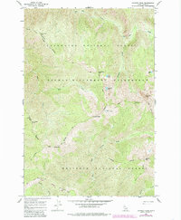
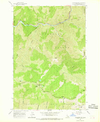
1966 Map of Chimney Peak
USGS Topo · Published 1985About this map
Chimney Peak stands as a prominent landmark within this high-elevation landscape, where the Selway-Bitterroot Wilderness converges with the Clearwater National Forest and Nez Perce National Forest. The topography is defined by sharp ridgelines like Wilderness Ridge and Glover Roundtop Ridge, which separate deep drainages fed by Old Man Creek and Split Creek. A series of alpine basins contain isolated water bodies including Chimney Lake, Louse Lake, and Flea Lake. Access across this complex terrain in the mid-1960s relied heavily on a network of primitive routes, such as the National Forest Pack Trail and various segments of the Pack Boundary Trail. These paths trace the contours near Ghost Mtn and The Crags, illustrating the remote character of this North Idaho interior before modern infrastructure reached these high divides.
Find a feature on this map
29 named features on this map. Tap any name to fly to it.
Don’t see what you’re looking for? This feature index may not catch every label — zoom into the map to look around manually.
Map Details
Editions of this 1966 Chimney Peak Map
2 editions found
Other maps of this area

1911 · Lolo
USGS Topo · 1:250,000

1913 · Lolo
USGS Topo · 1:250,000

1956 · Hamilton
USGS Topo · 1:250,000

1959 · Hamilton
USGS Topo · 1:250,000

1960 · Hamilton
USGS Topo · 1:250,000

1964 · Hamilton
USGS Topo · 1:250,000

1966 · Selway Falls
USGS Topo · 1:24,000
1966 · Stillman Point
USGS Topo · 1:24,000
1966 · Fog Mountain
USGS Topo · 1:24,000
1966 · Coolwater Mtn
USGS Topo · 1:24,000