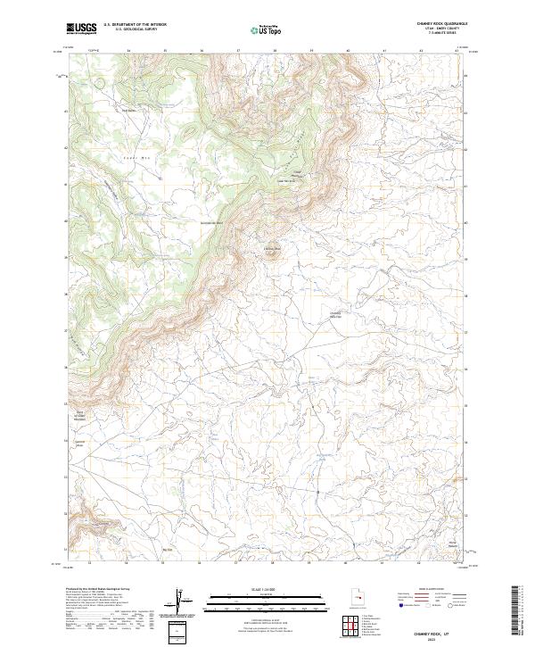
2023 Map of Chimney Rock
USGS Topo · Published 2023About this map
Chimney Rock rises as a central landmark in this high-desert portion of the San Rafael Swell, overlooking a landscape defined by dramatic plateaus and drainage systems. The terrain transitions from the elevated Cedar Mtn and Huff Bench in the north to the broad expanse of Big Flat in the south. This area is characterized by its vital water sources, with several isolated springs such as Wiregrass Spring, Birch Spring, and Gooseberry Spring supporting the local ecosystem.
Find a feature on this map
24 named features on this map. Tap any name to fly to it.
Don’t see what you’re looking for? This feature index may not catch every label — zoom into the map to look around manually.
Map Details
Editions of this 2023 Chimney Rock Map
This is the sole edition of this map. No revisions or reprints were ever made.
Other maps of this area

1886 · Price River
USGS Topo · 1:250,000

1896 · Price River
USGS Topo · 1:250,000

1948 · Woodside
USGS Topo · 1:62,500

1949 · Woodside
USGS Topo · 1:62,500

1950 · Woodside
USGS Topo · 1:62,500

1953 · Red Plateau SE
USGS Topo · 1:24,000

1953 · Red Plateau SW
USGS Topo · 1:24,000

1953 · Beckwith Peak SW
USGS Topo · 1:24,000

1956 · Price
USGS Topo · 1:250,000

1960 · Price
USGS Topo · 1:250,000