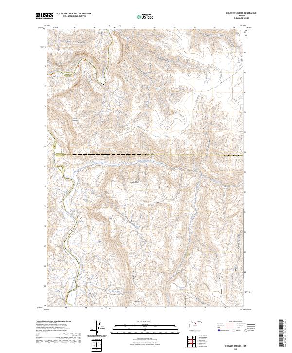
2023 Map of Chimney Springs
USGS Topo · Published 2023About this map
The John Day Wild and Scenic River defines the western edge of this landscape, carving a deep valley through the high desert of north-central Oregon. This 2023 survey illustrates the complex drainage patterns of the region, where numerous named canyons like Devils Canyon and Chimney Springs Canyon feed into larger water systems. Human activity is sparse and dictated by the terrain, centered around ranching and transit via routes such as Butte Creek Rd and Buckhorn Ln. Local water sources are critical landmarks in this arid environment, including Chimney Springs, Cabin Spring, and East Frickey Spring. The map covers the convergence of four counties—Sherman, Gilliam, Wheeler, and Wasco—reflecting the historical administrative boundaries that meet in this rugged corridor. Elevated features such as Horse Mountain and the broad Juniper Flat provide a clear view of the topographic relief between the river basin and the surrounding plateaus.
Find a feature on this map
34 named features on this map. Tap any name to fly to it.
Don’t see what you’re looking for? This feature index may not catch every label — zoom into the map to look around manually.
Map Details
Editions of this 2023 Chimney Springs Map
This is the sole edition of this map. No revisions or reprints were ever made.
Other maps of this area

1916 · Condon
USGS Topo · 1:125,000

1926 · Mitchell
USGS Topo · 1:125,000

1953 · The Dalles
USGS Topo · 1:250,000

1955 · Bend
USGS Topo · 1:250,000

1956 · The Dalles
USGS Topo · 1:250,000

1957 · Bend
USGS Topo · 1:250,000

1957 · The Dalles
USGS Topo · 1:250,000

1958 · Bend
USGS Topo · 1:250,000

1966 · Antelope
USGS Topo · 1:62,500

1966 · Clarno
USGS Topo · 1:62,500