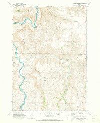
1970 Map of Chimney Springs
USGS Topo · Published 1973About this map
The John Day River winds through the northwestern corner of this territory, defining the sharp boundaries between Sherman, Gilliam, and Wasco counties. This high-desert landscape is heavily carved by drainage systems like Pete Enyart Canyon and Chimney Springs Canyon, where the topography dictated the placement of isolated outposts such as Buckhorn Ranch. Settlers and ranchers in this arid region relied on scattered water sources like Duncan Spring and Big Spring, often marking their locations with infrastructure like the Cistern near Jeager.
Find a feature on this map
33 named features on this map. Tap any name to fly to it.
Don’t see what you’re looking for? This feature index may not catch every label — zoom into the map to look around manually.
Map Details
Editions of this 1970 Chimney Springs Map
This is the sole edition of this map. No revisions or reprints were ever made.
Other maps of this area

1916 · Condon
USGS Topo · 1:125,000

1926 · Mitchell
USGS Topo · 1:125,000

1953 · The Dalles
USGS Topo · 1:250,000

1955 · Bend
USGS Topo · 1:250,000

1956 · The Dalles
USGS Topo · 1:250,000

1957 · Bend
USGS Topo · 1:250,000

1957 · The Dalles
USGS Topo · 1:250,000

1958 · Bend
USGS Topo · 1:250,000

1966 · Antelope
USGS Topo · 1:62,500

1966 · Clarno
USGS Topo · 1:62,500