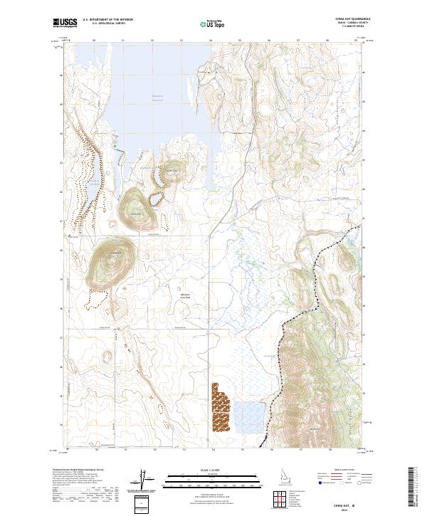
2024 Map of China Hat
USGS Topo · Published 2024About this map
China Hat and China Cap rise as prominent volcanic landmarks within this high-elevation corner of Caribou County. The landscape is defined by the massive Blackfoot Lava Field, a complex basaltic terrain that contrasts with the seasonal wetlands and marshy stretches of the Blackfoot River corridor. To the north, the waters of the Blackfoot Reservoir dominate the horizon, while the eastern edge of the map is framed by the rising slopes of the Aspen Range and the distinctive Woodall Mtn.
Find a feature on this map
29 named features on this map. Tap any name to fly to it.
Don’t see what you’re looking for? This feature index may not catch every label — zoom into the map to look around manually.
Map Details
Editions of this 2024 China Hat Map
This is the sole edition of this map. No revisions or reprints were ever made.
Other maps of this area

1911 · Slug Creek
USGS Topo · 1:62,500

1914 · Henry
USGS Topo · 1:48,000

1915 · Lanes Creek
USGS Topo · 1:62,500

1916 · Henry
USGS Topo · 1:62,500

1948 · Soda Springs
USGS Topo · 1:62,500

1949 · Soda Springs
USGS Topo · 1:62,500

1949 · Johnson Creek
USGS Topo · 1:24,000

1949 · Lower Valley
USGS Topo · 1:24,000

1951 · Lower Valley
USGS Topo · 1:24,000
1951 · Johnson Creek
USGS Topo · 1:24,000