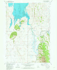
1981 Map of China Hat
USGS Topo · Published 1981About this map
Blackfoot Reservoir dominates the northwestern landscape of this Idaho interior, its waters contained by the China Cap Dam and an extensive Dike. This 1981 edition captures a transitional era in the Aspen Range, where industrial phosphate operations at the Conda Mine and extractive activity at various Gravel Pits coexist with high-desert grazing lands. Transportation and utility corridors are well-established, featuring the Union Pacific rail line and the Blackfoot River Road following the winding Blackfoot River. Family history and local heritage are marked by the settlement at Meadowville, a lonely Cem (cemetery), and isolated landmarks like Enders and Woodall Ranch. Distinctive geological features, including the volcanic profiles of China Hat, China Cap, and North Cone, provide a clear sense of the area's volcanic topography south of Long Valley.
Find a feature on this map
40 named features on this map. Tap any name to fly to it.
Don’t see what you’re looking for? This feature index may not catch every label — zoom into the map to look around manually.
Map Details
Editions of this 1981 China Hat Map
This is the sole edition of this map. No revisions or reprints were ever made.
Other maps of this area

1911 · Slug Creek
USGS Topo · 1:62,500

1914 · Henry
USGS Topo · 1:48,000

1915 · Lanes Creek
USGS Topo · 1:62,500

1916 · Henry
USGS Topo · 1:62,500

1948 · Soda Springs
USGS Topo · 1:62,500

1949 · Soda Springs
USGS Topo · 1:62,500

1949 · Johnson Creek
USGS Topo · 1:24,000

1949 · Lower Valley
USGS Topo · 1:24,000

1951 · Lower Valley
USGS Topo · 1:24,000
1951 · Johnson Creek
USGS Topo · 1:24,000