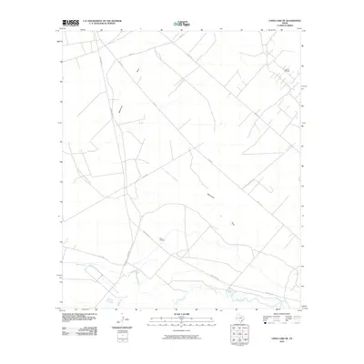
2010 Map of China Lake NE
USGS Topo · Published 2010About this map
Wilks Cemetery stands as a quiet focal point in this Reeves County landscape, situated near the intersection of Ranch Rd 1927 and Co Rd 412. This region is defined by its industrial and hydraulic infrastructure, where the Spencer Oil Field occupies the northeastern corner while the southern reaches are shaped by the Pecos River. The map captures a moment in 2010 when the drainage of Monument Draw and the engineered paths of the Big Valley Canal were essential to the local environment. A network of county roads, including Co Rd 425 and Co Rd 4280, crisscrosses the arid terrain, illustrating the connectivity required for resource extraction and rural life in West Texas.
Find a feature on this map
12 named features on this map. Tap any name to fly to it.
Don’t see what you’re looking for? This feature index may not catch every label — zoom into the map to look around manually.
Map Details
Editions of this 2010 China Lake NE Map
This is the sole edition of this map. No revisions or reprints were ever made.
Other maps of this area

1931 · Barstow
USGS Topo · 1:125,000

1954 · Pecos
USGS Topo · 1:250,000

1957 · Pecos
USGS Topo · 1:250,000

1963 · Ligon Ranch
USGS Topo · 1:24,000

1963 · China Lake NE
USGS Topo · 1:24,000

1963 · Rio Pecos Ranch
USGS Topo · 1:24,000

1963 · China Lake
USGS Topo · 1:24,000

1969 · Pyote East
USGS Topo · 1:24,000

1969 · Monahans
USGS Topo · 1:24,000

1969 · 7 L Ranch
USGS Topo · 1:24,000