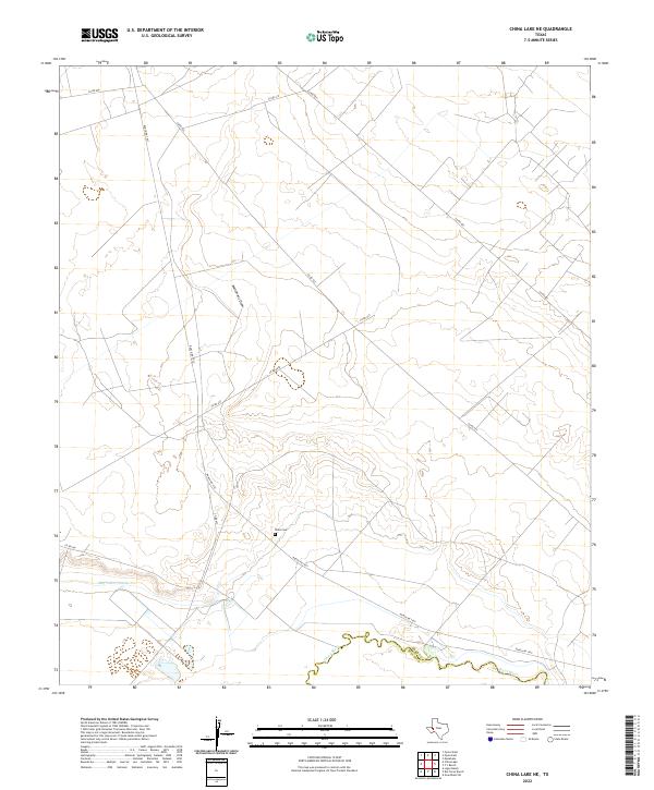
2022 Map of China Lake NE
USGS Topo · Published 2022About this map
The Pecos River carves the southern boundary of this West Texas landscape, marking the transition between Ward and Reeves counties. This arid stretch is defined by a network of drainage patterns and water management features, including the prominent Monument Draw that cuts through the central terrain and the Big Valley Canal running parallel to the river valley. Sparse ranching infrastructure is anchored by a system of county roads and Ranch Rd 1927. Local history and genealogy are tied to the small Wilks Cem, a quiet landmark located just off the main ranch road. The map illustrates the specialized water infrastructure required for agriculture in this region, where topographic contours reveal the subtle elevation shifts above the river basin.
Find a feature on this map
12 named features on this map. Tap any name to fly to it.
Don’t see what you’re looking for? This feature index may not catch every label — zoom into the map to look around manually.
Map Details
Editions of this 2022 China Lake NE Map
This is the sole edition of this map. No revisions or reprints were ever made.
Other maps of this area

1931 · Barstow
USGS Topo · 1:125,000

1954 · Pecos
USGS Topo · 1:250,000

1957 · Pecos
USGS Topo · 1:250,000

1963 · Ligon Ranch
USGS Topo · 1:24,000

1963 · China Lake NE
USGS Topo · 1:24,000

1963 · Rio Pecos Ranch
USGS Topo · 1:24,000

1963 · China Lake
USGS Topo · 1:24,000

1969 · Pyote East
USGS Topo · 1:24,000

1969 · Monahans
USGS Topo · 1:24,000

1969 · 7 L Ranch
USGS Topo · 1:24,000