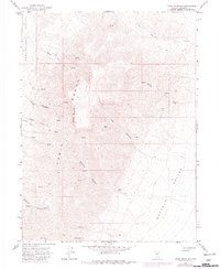
1965 Map of China Mountain
USGS Topo · Published 1981About this map
The Tobin Range dominates this mid-century survey, forming a high central divide between two expansive basins. To the west lies Pumpernickel Valley, while Buffalo Valley stretches to the southeast. The terrain is defined by a series of steep drainages, including Garden Canyon and Ragan Canyon, which carve the western slopes. Evidence of human activity and early settlement in this part of Pershing County is sparse but present, notably at Hoffman Ranch situated near the mouth of Hoffman Canyon. Small-scale resource extraction is indicated by a Mine and Prospect located along the upper reaches of Cherry Creek. A network of Jeep Trails and 4wd tracks provides the primary access through the high country, connecting various Springs that served as vital water sources for livestock and travelers in this arid landscape.
Find a feature on this map
22 named features on this map. Tap any name to fly to it.
Don’t see what you’re looking for? This feature index may not catch every label — zoom into the map to look around manually.
Map Details
Editions of this 1965 China Mountain Map
2 editions found
Other maps of this area

1932 · Sonoma Range
USGS Topo · 1:250,000

1939 · Sonoma Range
USGS Topo · 1:250,000

1955 · Winnemucca
USGS Topo · 1:250,000

1958 · Winnemucca
USGS Topo · 1:250,000

1961 · Mt. Tobin
USGS Topo · 1:62,500

1961 · Leach Hot Springs
USGS Topo · 1:62,500

1962 · Winnemucca
USGS Topo · 1:250,000

1962 · Buffalo Springs
USGS Topo · 1:62,500
1965 · Cherry Creek NE
USGS Topo · 1:24,000
1965 · Smelser Pass
USGS Topo · 1:24,000