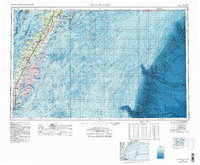
1984 Map of Chincoteague
USGS Topo · Published 1984About this map
Accomack County and Northampton County form the backbone of this mid-1980s topographic-bathymetric study, illustrating the intricate relationship between the Virginia Eastern Shore and the Atlantic Ocean. The landscape is dominated by a string of barrier islands, including Assateague Island, Wallops Island, and Hog Island, which shield a complex network of coastal bays and inlets. Modern technological footprints are evident at the Wallops Flight Facility (NASA) and Cape Charles Air Force Station, contrasting with the preserved natural reaches of the Chincoteague Nat Wildlife Refuge and Martin Nat Wildlife Refuge. Inland, the map details the established settlement patterns of the Delmarva Peninsula, from the fishing port of Crisfield to the county seat at Accomac. The Penn Central railroad corridor remains a defining feature, tracing the path of commerce through towns like Parksley and Melfa while numerous creeks, such as Onancock Creek, reach deep into the farmland from the Chesapeake Bay.
Find a feature on this map
109 named features on this map. Tap any name to fly to it.
Don’t see what you’re looking for? This feature index may not catch every label — zoom into the map to look around manually.
Map Details
Editions of this 1984 Chincoteague Map
2 editions found
Other maps of this area

1893 · Virginia Beach
USGS Topo · 1:125,000

1898 · St. Marys
USGS Topo · 1:125,000

1901 · Snow Hill
USGS Topo · 1:62,500

1901 · Green Run
USGS Topo · 1:62,500

1903 · Crisfield
USGS Topo · 1:62,500

1903 · Bloodsworth Island
USGS Topo · 1:62,500

1903 · Deal Island
USGS Topo · 1:62,500

1906 · St. Marys
USGS Topo · 1:125,000

1907 · Norfolk
USGS Topo · 1:125,000

1917 · Ewell
USGS Topo · 1:62,500