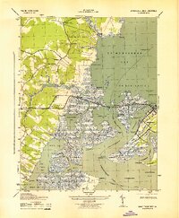
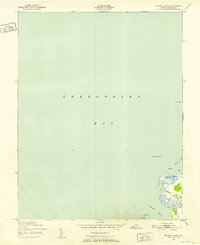
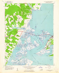
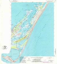
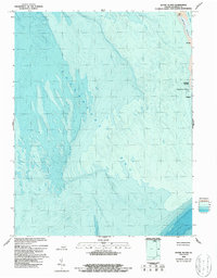
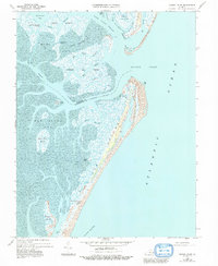
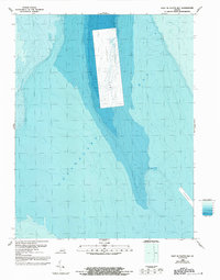
1943 Map of Chincoteague West
USGS Topo · Published 1943This historical map portrays the area of Chincoteague West in 1943, primarily covering Accomack County. Featuring a scale of 1:31680, this map provides a highly detailed snapshot of the terrain, roads, buildings, counties, and historical landmarks in the Chincoteague West region at the time. Published in 1943, it is one of 2 known editions of this map due to revisions or reprints.
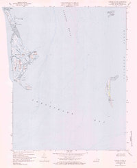
Find a feature on this map
44 named features on this map. Tap any name to fly to it.
Don’t see what you’re looking for? This feature index may not catch every label — zoom into the map to look around manually.
Map Details
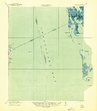
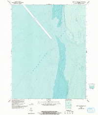
Editions of this 1943 Chincoteague West Map
2 editions found
Historical Maps of Wishart Through Time
29 maps found
1917 Ewell
Accomack County, VA
1942 Chesconessex
Accomack County, VA
1942 Chincoteague East
Accomack County, VA

1942 Ewell
Accomack County, VA

1942 Little Machipongo Inlet
Accomack County, VA
1942 Nandua Creek
Accomack County, VA
1942 Tangier Island
Accomack County, VA
1942 Wallops Island
Accomack County, VA
1943 Chincoteague East
Accomack County, VA
1943 Chincoteague West
Accomack County, VA
1943 Tangier Island
Accomack County, VA
1943 Wallops Island
Accomack County, VA
1957 Metomkin Inlet
Accomack County, VA
1965 Chincoteague East
Accomack County, VA
1965 Chincoteague West
Accomack County, VA
1965 Wallops Island
Accomack County, VA
1968 Chesconessex
Accomack County, VA
1968 Goose Island
Accomack County, VA
1968 Great Fox Island
Accomack County, VA
1968 Metompkin Inlet
Accomack County, VA
1968 Nandua Creek
Accomack County, VA
1968 Quinby Inlet
Accomack County, VA
1968 Tangier Island
Accomack County, VA
1978 Chincoteague East
Accomack County, VA
1978 Quinby Inlet
Accomack County, VA
1986 East of Fleets Bay
Accomack County, VA
1986 West of Jamesville
Accomack County, VA
1986 West of Nandua Creek
Accomack County, VA
1999 Chincoteague East
Accomack County, VA