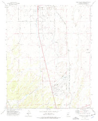
1973 Map of Chino Valley South
USGS Topo · Published 1977About this map
Prescott Municipal Airport anchors the southern portion of this mid-1970s landscape, illustrating the aviation-driven expansion near the Prescott corporate boundary. The area reflects a transition from rural ranching and infrastructure to specialized landing sites, including the Cooper Farm Landing Strip and Robin Landing Field. Water management is a defining characteristic of the terrain, with the Chino Valley Irrigation Ditch and the Chino Valley Aqueduct cutting across the valley to support local agriculture.
Find a feature on this map
25 named features on this map. Tap any name to fly to it.
Don’t see what you’re looking for? This feature index may not catch every label — zoom into the map to look around manually.
Map Details
Editions of this 1973 Chino Valley South Map
2 editions found
Other maps of this area

1887 · Prescott
USGS Topo · 1:250,000

1892 · Prescott
USGS Topo · 1:250,000

1905 · Jerome
USGS Topo · 1:125,000

1947 · Simmons
USGS Topo · 1:62,500

1947 · Iron Springs
USGS Topo · 1:62,500

1947 · Paulden
USGS Topo · 1:62,500

1947 · Prescott
USGS Topo · 1:62,500

1948 · Iron Springs
USGS Topo · 1:63,360

1948 · Prescott
USGS Topo · 1:62,500

1948 · Simmons
USGS Topo · 1:63,360