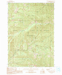
1990 Map of Chinook Mountain
USGS Topo · Published 1991About this map
The Frank Church - River of No Return Wilderness dominates this portion of Idaho's backcountry, where the drainage systems of Pistol Creek and North Fork Elkhorn Creek converge. The landscape is defined by its mining history and rugged access routes, with the Cougar Mine, Franklin D Mine, and Lucky Lad Mine tucked into the steep drainages. High points such as Chinook Mountain and Walkers Peak overlook a complex network of named waterways including Winchester Creek and Popgun Creek. This 1990 provisional update illustrates the intersection of industrial pursuit and conservation within the Boise National Forest. Local navigation relies on established routes like the Luger Trail and Automatic Trail, which trace the high ridges and steep valleys. The naming conventions, from Shrapnel Ridge to Gun Creek, reflect a specific cultural imprint on this protected wilderness area.
Find a feature on this map
25 named features on this map. Tap any name to fly to it.
Don’t see what you’re looking for? This feature index may not catch every label — zoom into the map to look around manually.
Map Details
Editions of this 1990 Chinook Mountain Map
This is the sole edition of this map. No revisions or reprints were ever made.
Other maps of this area

1937 · Yellow Pine
USGS Topo · 1:48,000

1943 · Yellow Pine
USGS Topo · 1:62,500

1957 · Challis
USGS Topo · 1:250,000

1960 · Challis
USGS Topo · 1:250,000

1961 · Greyhound Ridge
USGS Topo · 1:62,500

1961 · Chinook Mtn
USGS Topo · 1:62,500

1963 · Challis
USGS Topo · 1:250,000
1973 · Big Chief Creek
USGS Topo · 1:24,000
1973 · Big Baldy
USGS Topo · 1:24,000
1973 · Chilcoot Peak
USGS Topo · 1:24,000