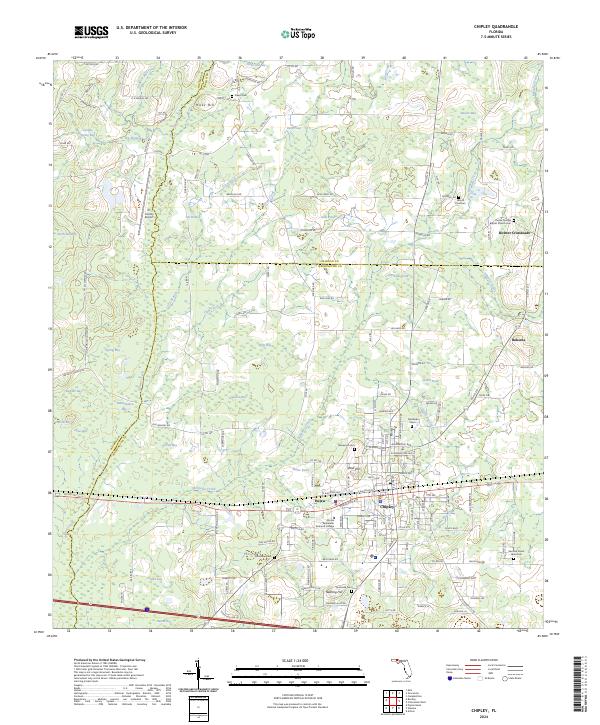
2024 Map of Chipley
USGS Topo · Published 2024About this map
Chipley serves as a significant junction in the Florida Panhandle, where the railroad corridor intersects with a network of local roads and watercourses. The landscape is defined by its numerous "bays" and ponds, such as Hicks Old Bay and Notch Pond, alongside the meandering path of Holmes Creek. Historically significant markers for genealogists are abundant, including Salem Cem, Mount Zion Cem, and Limestone Cem. The presence of the Florida Panhandle Technical College and Tri-County Airport highlights the area's role as a regional hub. Smaller settlements like Richter Crossroads and Bahoma punctuate the outlying terrain, while the city center of Chipley is detailed down to street-level names like W Jackson Ave and S Railroad Ave. This survey captures a rural landscape transitioning into an organized municipal center, anchored by its proximity to several county boundaries.
Find a feature on this map
91 named features on this map. Tap any name to fly to it.
Don’t see what you’re looking for? This feature index may not catch every label — zoom into the map to look around manually.
Map Details
Editions of this 2024 Chipley Map
This is the sole edition of this map. No revisions or reprints were ever made.
Other maps of this area

1950 · Chipley
USGS Topo · 1:24,000

1950 · Wausau
USGS Topo · 1:24,000

1950 · Esto
USGS Topo · 1:24,000

1950 · Poplar Head
USGS Topo · 1:24,000

1951 · Graceville
USGS Topo · 1:24,000

1951 · Esto
USGS Topo · 1:24,000

1951 · Chipley
USGS Topo · 1:24,000

1951 · Wausau
USGS Topo · 1:24,000
1951 · Poplar Head
USGS Topo · 1:24,000

1951 · Bonifay
USGS Topo · 1:24,000