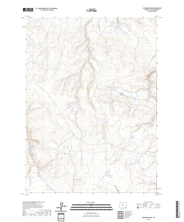
2023 Map of Chipmunk Basin
USGS Topo · Published 2023About this map
Chipmunk Basin occupies a high-elevation landscape in Malheur County, where water is the primary driver of name and place. This high desert terrain is defined by a series of isolated water sources essential for cattle and wildlife, including Chipmunk Spring, Exchange Spring, and Coffeepot Spring. These points of reliable water likely served as vital hubs for local ranching operations, a role echoed by the presence of man-made structures like Steer Canyon Reservoir and Horse Hill Reservoir. The sparse human imprint on the land is represented by Pole Creek Rd, which winds through the basin near Horse Hill. Notable drainage patterns include Big Antelope Creek and the curiously named Bend-of-Pole Creek, illustrating how the local geography has been navigated and labeled by those working this arid portion of southeastern Oregon.
Find a feature on this map
28 named features on this map. Tap any name to fly to it.
Don’t see what you’re looking for? This feature index may not catch every label — zoom into the map to look around manually.
Map Details
Editions of this 2023 Chipmunk Basin Map
This is the sole edition of this map. No revisions or reprints were ever made.
Other maps of this area

1955 · Jordan Valley
USGS Topo · 1:250,000

1957 · Jordan Valley
USGS Topo · 1:250,000

1958 · Jordan Valley
USGS Topo · 1:250,000
1982 · Starvation Spring
USGS Topo · 1:24,000

1982 · Guadalupe Meadows
USGS Topo · 1:24,000
1982 · Grasshopper Flat North
USGS Topo · 1:24,000
1982 · Rawhide Springs
USGS Topo · 1:24,000
1982 · Oregon Butte
USGS Topo · 1:24,000
1982 · Chipmunk Basin
USGS Topo · 1:24,000
1982 · Grasshopper Flat South
USGS Topo · 1:24,000