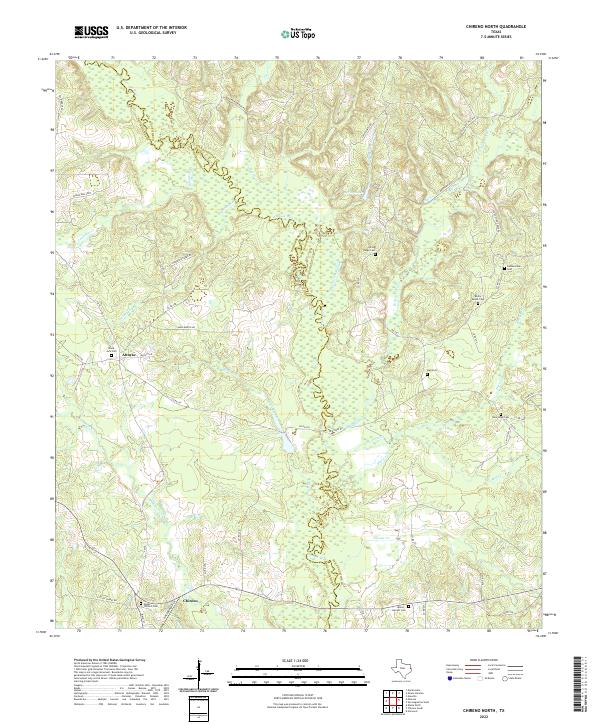
2022 Map of Chireno North
USGS Topo · Published 2022About this map
The winding Attoyac River forms a complex natural boundary between Nacogdoches and San Augustine counties, characterized by a series of low-lying wetlands and seasonal drainages. The southern portion of the map is anchored by the community of Chireno, where local history is preserved at the Upper Chireno Cem near Gingerbread Ln. This area of East Texas is defined by its numerous small creek systems, such as Big Iron Ore Cr and Tupelo Gum Slough, which feed into the primary river basin.
Find a feature on this map
59 named features on this map. Tap any name to fly to it.
Don’t see what you’re looking for? This feature index may not catch every label — zoom into the map to look around manually.
Map Details
Editions of this 2022 Chireno North Map
This is the sole edition of this map. No revisions or reprints were ever made.
Other maps of this area

1953 · Palestine
USGS Topo · 1:250,000

1957 · Palestine
USGS Topo · 1:250,000

1958 · Broaddus
USGS Topo · 1:62,500

1958 · San Augustine
USGS Topo · 1:62,500

1958 · Martinsville
USGS Topo · 1:62,500

1958 · Bronson
USGS Topo · 1:62,500

1984 · Norwood
USGS Topo · 1:24,000
1984 · Etoile North
USGS Topo · 1:24,000
1984 · Chireno South
USGS Topo · 1:24,000

1984 · Palestine
USGS Topo · 1:250,000