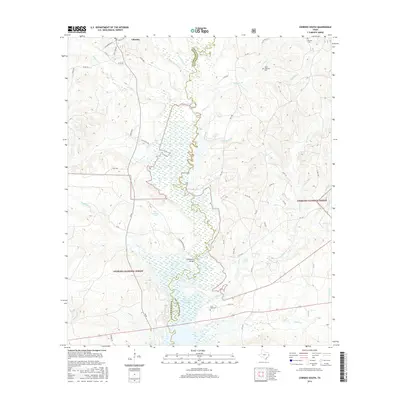
2016 Map of Chireno South
USGS Topo · Published 2016About this map
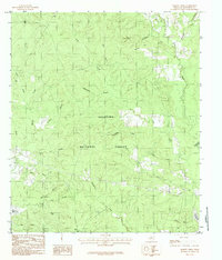
The Attoyac River carves a winding path along the boundary between Nacogdoches and San Augustine counties, serving as the central artery for this East Texas landscape. To the west, the community of Chireno sits near the northern edge, while the southern reaches are defined by the dense acreage of the Angelina National Forest. This 2016 survey illustrates a region where water and timber dictate the layout of roads and settlements, notably where the river feeds into the Sam Rayburn Reservoir. Genealogists will find significant local landmarks including Woolam Cem, Davis - Anderson Cem, and Saint John Cem. Historical crossing points such as Cottingham Bridge and natural features like Bullock Springs and B E Gartman Lake provide a clear view of the rural infrastructure. The map also documents named property such as O Bar Ranch, reflecting the enduring agricultural and ranching character of the Pineywoods.
Find a feature on this map
56 named features on this map. Tap any name to fly to it.
Don’t see what you’re looking for? This feature index may not catch every label — zoom into the map to look around manually.
Map Details
Editions of this 2016 Chireno South Map
This is the sole edition of this map. No revisions or reprints were ever made.
Other maps of this area

1953 · Palestine
USGS Topo · 1:250,000

1957 · Palestine
USGS Topo · 1:250,000
1958 · Broaddus
USGS Topo · 1:62,500
1958 · San Augustine
USGS Topo · 1:62,500
1958 · Martinsville
USGS Topo · 1:62,500
1958 · Bronson
USGS Topo · 1:62,500
1984 · Norwood
USGS Topo · 1:24,000
1984 · Etoile North
USGS Topo · 1:24,000
1984 · Chireno South
USGS Topo · 1:24,000
1984 · Harvey Creek
USGS Topo · 1:24,000