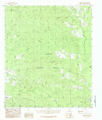
1984 Map of Harvey Creek
USGS Topo · Published 1984About this map
The Angelina National Forest dominates this landscape in San Augustine County, revealing a dense network of tributaries feeding into the Sam Rayburn Reservoir along the eastern edge. This 1984 provisional survey documents a transition in the local topography, where the high ground of Turkey Hill and Bannister Hill gives way to numerous creek systems. The settlement of White City sits at the southern reach of the map, serving as a primary point of reference for local genealogy and history researchers.
Find a feature on this map
30 named features on this map. Tap any name to fly to it.
Don’t see what you’re looking for? This feature index may not catch every label — zoom into the map to look around manually.
Map Details
Editions of this 1984 Harvey Creek Map
This is the sole edition of this map. No revisions or reprints were ever made.
Other maps of this area

1931 · Zavalla
USGS Topo · 1:62,500

1953 · Palestine
USGS Topo · 1:250,000

1957 · Palestine
USGS Topo · 1:250,000

1958 · Zavalla
USGS Topo · 1:62,500

1958 · Broaddus
USGS Topo · 1:62,500

1958 · Mc Gee Bend
USGS Topo · 1:62,500

1958 · Bronson
USGS Topo · 1:62,500

1984 · Norwood
USGS Topo · 1:24,000
1984 · Veach
USGS Topo · 1:24,000
1984 · Chireno South
USGS Topo · 1:24,000