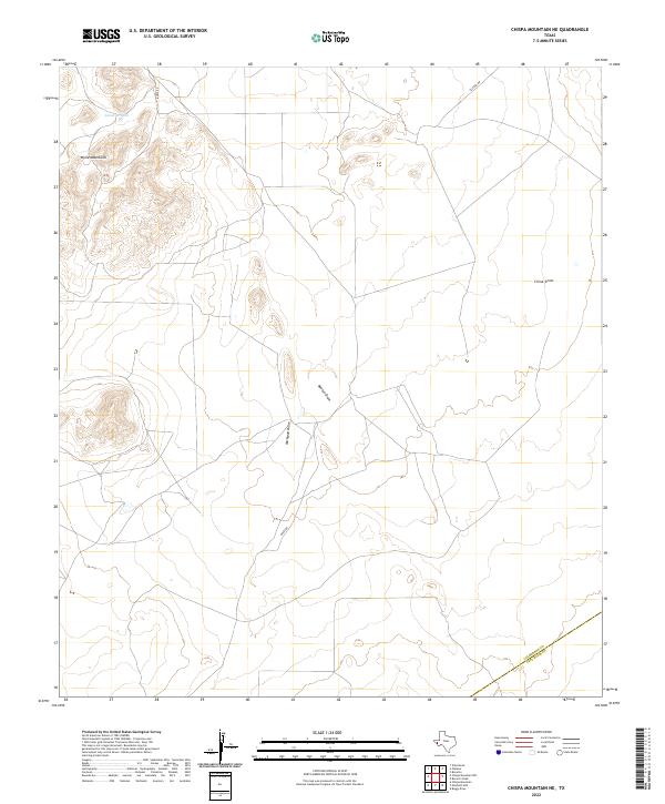
2022 Map of Chispa Mountain NE
USGS Topo · Published 2022About this map
Wylie Mountains dominate the western horizon of this high-desert landscape in Trans-Pecos Texas. The terrain is defined by a network of drainage systems, including Bunton Draw, Michigan Draw, and China Draw, which illustrate the natural watershed patterns of this arid region. Man-made infrastructure is sparse, limited to ranching-related features like Javelina Tank and remote thoroughfares such as Baeza Rd and Plateau Rd. The map also captures the administrative boundary between Culberson Co and Jeff Davis Co in the southeastern corner. This modern survey reflects the enduring character of a landscape that remains largely unchanged in its fundamental topography and ranching utility, serving as a reliable reference for the vast, open spaces of West Texas.
Find a feature on this map
8 named features on this map. Tap any name to fly to it.
Don’t see what you’re looking for? This feature index may not catch every label — zoom into the map to look around manually.
Map Details
Editions of this 2022 Chispa Mountain NE Map
This is the sole edition of this map. No revisions or reprints were ever made.
Other maps of this area

1892 · Chispa
USGS Topo · 1:125,000

1894 · Valentine
USGS Topo · 1:125,000

1895 · Chispa
USGS Topo · 1:125,000

1897 · Valentine
USGS Topo · 1:125,000

1897 · Chispa
USGS Topo · 1:125,000

1906 · Van Horn
USGS Topo · 1:125,000

1928 · Kent
USGS Topo · 1:125,000

1943 · Valentine
USGS Topo · 1:125,000

1954 · Van Horn
USGS Topo · 1:250,000

1958 · Van Horn
USGS Topo · 1:250,000