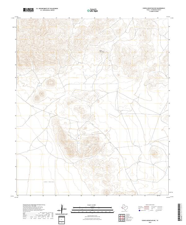
2022 Map of Chispa Mountain NW
USGS Topo · Published 2022About this map
The high peaks of the Wylie Mountains dominate the northern portion of this Culberson County landscape, giving way to the broad, flat expanse of the Lobo Valley in the south. This terrain is defined by extreme elevation changes, where drainage patterns from the uplands disappear into the valley floor. Human activity is sparse, marked primarily by the winding path of 101 Rd, which serves as a solitary corridor through this arid West Texas region. The map illustrates a traditional ranching or high-desert landscape where infrastructure is minimal, focusing instead on the complex topography and natural basins that characterize this part of the Trans-Pecos.
Find a feature on this map
3 named features on this map. Tap any name to fly to it.
Don’t see what you’re looking for? This feature index may not catch every label — zoom into the map to look around manually.
Map Details
Editions of this 2022 Chispa Mountain NW Map
This is the sole edition of this map. No revisions or reprints were ever made.
Other maps of this area

1892 · Chispa
USGS Topo · 1:125,000

1895 · Chispa
USGS Topo · 1:125,000

1897 · Chispa
USGS Topo · 1:125,000

1906 · Van Horn
USGS Topo · 1:125,000

1954 · Van Horn
USGS Topo · 1:250,000

1958 · Van Horn
USGS Topo · 1:250,000

1959 · Marfa
USGS Topo · 1:250,000

1964 · Wild Horse
USGS Topo · 1:24,000

1964 · Van Horn
USGS Topo · 1:24,000
1964 · Plateau
USGS Topo · 1:24,000