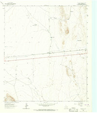
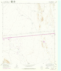
1964 Map of Plateau
USGS Topo · Published 1967About this map
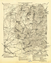
Plateau serves as a small but vital hub in Culberson County, situated along the southern edge of the Texas and Pacific railroad during the mid-1960s. This arid landscape is defined by its water management, where numerous catchment basins such as Plateau Sandhill Tank, Plateau Tank, and Cockleburr Tank highlight the critical importance of water for ranching and transit in West Texas. The terrain is marked by seasonal drainages including Sacaton Draw and Michigan Draw, which cut through the high desert flats near the prominent rising of Cowper. Evidence of early industrial exploration and infrastructure is scattered across the sheet, from a remote Drill Hole in the northern reaches to a Gravel Pit near the railroad, reflecting a period when the region's economy relied heavily on both the rail line and the extraction of local materials.
Find a feature on this map
12 named features on this map. Tap any name to fly to it.
Don’t see what you’re looking for? This feature index may not catch every label — zoom into the map to look around manually.
Map Details
Editions of this 1964 Plateau Map
2 editions found
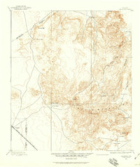
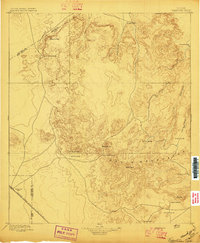
Other maps of this area

1892 · Chispa
USGS Topo · 1:125,000
1894 · Valentine
USGS Topo · 1:125,000

1895 · Chispa
USGS Topo · 1:125,000
1897 · Valentine
USGS Topo · 1:125,000

1897 · Chispa
USGS Topo · 1:125,000

1906 · Van Horn
USGS Topo · 1:125,000

1928 · Kent
USGS Topo · 1:125,000
1943 · Valentine
USGS Topo · 1:125,000

1954 · Van Horn
USGS Topo · 1:250,000

1958 · Van Horn
USGS Topo · 1:250,000