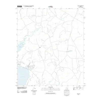
2010 Map of Chita
USGS Topo · Published 2010About this map
The Livingston Reservoir and the winding course of the Trinity River dominate the western portion of this East Texas landscape. Near the riverside, the settlement of Sebastopol is mapped with its street grid including Port Blvd and Settler's Way E, reflecting the area's development along the water's edge. To the northeast, the community of Chita sits inland, surrounded by a network of rural roads and creek drainages.
Find a feature on this map
32 named features on this map. Tap any name to fly to it.
Don’t see what you’re looking for? This feature index may not catch every label — zoom into the map to look around manually.
Map Details
Editions of this 2010 Chita Map
This is the sole edition of this map. No revisions or reprints were ever made.
Other maps of this area

1953 · Palestine
USGS Topo · 1:250,000

1954 · Beaumont
USGS Topo · 1:250,000

1957 · Beaumont
USGS Topo · 1:250,000

1957 · Palestine
USGS Topo · 1:250,000

1960 · Colita
USGS Topo · 1:24,000

1960 · Trinity East
USGS Topo · 1:24,000

1960 · Carlisle
USGS Topo · 1:24,000

1961 · Staley
USGS Topo · 1:24,000

1961 · Onalaska
USGS Topo · 1:24,000

1962 · Glendale
USGS Topo · 1:24,000