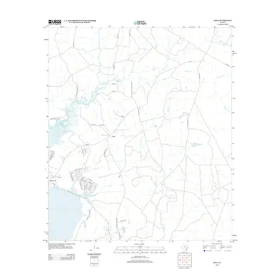
2013 Map of Chita
USGS Topo · Published 2013About this map
Chita and the community of Sebastopol anchor this Trinity County landscape, positioned along the northeastern shores of the Livingston Reservoir. The area is defined by a dense network of tributaries including Magnolia Cr, Brushy Cr, and Sulphur Cr which flow through the forested terrain. Evidence of local heritage and private development is visible in the naming of rural routes such as Chita Cemetery Rd, Old Lister Place Rd, and the Sulphur Creek Hunting Club Rd. Residential growth near the waterfront is marked by clusters of streets like Natasha Dr and Apache Ln, showing the shift from traditional timber or agricultural lands toward lakeside recreation. Further inland, Haynes Lake and numerous small drainages like Mill Cr and Haris Cr illustrate the complex hydrology of the Texas Piney Woods region.
Find a feature on this map
50 named features on this map. Tap any name to fly to it.
Don’t see what you’re looking for? This feature index may not catch every label — zoom into the map to look around manually.
Map Details
Editions of this 2013 Chita Map
This is the sole edition of this map. No revisions or reprints were ever made.
Other maps of this area

1953 · Palestine
USGS Topo · 1:250,000

1954 · Beaumont
USGS Topo · 1:250,000

1957 · Beaumont
USGS Topo · 1:250,000

1957 · Palestine
USGS Topo · 1:250,000

1960 · Colita
USGS Topo · 1:24,000

1960 · Trinity East
USGS Topo · 1:24,000

1960 · Carlisle
USGS Topo · 1:24,000

1961 · Staley
USGS Topo · 1:24,000

1961 · Onalaska
USGS Topo · 1:24,000

1962 · Glendale
USGS Topo · 1:24,000