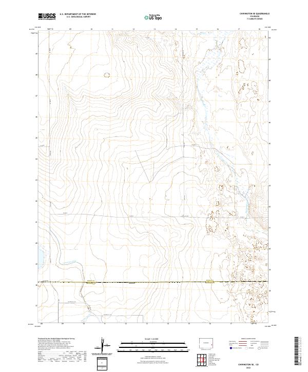
2022 Map of Chivington SE
USGS Topo · Published 2022About this map
Big Sandy Cr and Rush Cr meander through the high plains of eastern Colorado, defining the natural drainage of this open landscape. The terrain is a network of township and range divisions, where straight county roads like Co Rd 49 and Co Rd 53 intersect the dry streambeds and ephemeral wetlands. This 2022 survey captures the persistent agricultural infrastructure of the region, specifically the irrigation efforts evidenced by the Comanche Canal and the Pawnee Canal in the southern portion of the quadrangle. The map also delineates the border between Kiowa Co and Prowers Co, providing a clear view of how political boundaries and land management systems overlay the natural topography of the High Plains.
Find a feature on this map
21 named features on this map. Tap any name to fly to it.
Don’t see what you’re looking for? This feature index may not catch every label — zoom into the map to look around manually.
Map Details
Editions of this 2022 Chivington SE Map
This is the sole edition of this map. No revisions or reprints were ever made.
Other maps of this area

1890 · Granada
USGS Topo · 1:125,000

1892 · Lamar
USGS Topo · 1:125,000

1892 · Granada
USGS Topo · 1:125,000

1894 · Granada
USGS Topo · 1:125,000

1954 · Lamar
USGS Topo · 1:250,000

1955 · Granada NW
USGS Topo · 1:24,000

1955 · May Valley
USGS Topo · 1:24,000

1955 · Wiley
USGS Topo · 1:24,000

1958 · Lamar
USGS Topo · 1:250,000

1967 · Neenoshe Reservoir
USGS Topo · 1:24,000