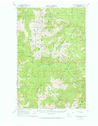
1965 Map of Chiwaukum Mts
USGS Topo · Published 1973About this map
Wenatchee National Forest dominates this mid-1960s survey, revealing a high-alpine landscape defined by its network of high-elevation basins and pack trails. The Chiwaukum Mountains and various ridges like Icicle Ridge and Jack Ridge structure the terrain, which is dotted with dozens of small lakes such as Loch Eileen, Chiwaukum Lake, and Lake Victoria. This era of the forest shows a well-established system of seasonal access points, including the Chatter Creek Campground and Ida Creek Campground located along the valley floors.
Find a feature on this map
118 named features on this map. Tap any name to fly to it.
Don’t see what you’re looking for? This feature index may not catch every label — zoom into the map to look around manually.
Map Details
Editions of this 1965 Chiwaukum Mts Map
2 editions found

Other maps of this area

1897 · Mount Stuart
USGS Topo · 1:125,000

1901 · Chiwaukum
USGS Topo · 1:125,000

1901 · Snoqualmie Pass
USGS Topo · 1:125,000

1902 · Skykomish
USGS Topo · 1:125,000

1902 · Mount Stuart
USGS Topo · 1:125,000

1903 · Snoqualmie
USGS Topo · 1:125,000

1904 · Chiwaukum
USGS Topo · 1:125,000

1905 · Skykomish
USGS Topo · 1:125,000

1957 · Wenatchee
USGS Topo · 1:250,000

1961 · Liberty
USGS Topo · 1:62,500