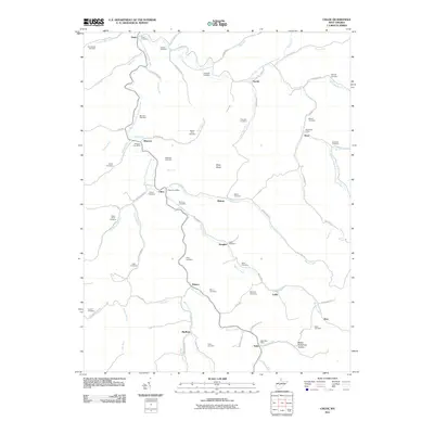
2011 Map of Chloe
USGS Topo · Published 2011About this map
The West Fork Little Kanawha River dictates the settlement patterns of this West Virginia landscape, winding through a network of hollows that defined early Appalachian community life. The 2011 survey reveals a high density of family-centric landmarks, particularly cemeteries such as Greathouse Cemetery, Mollohan Cemetery, and Bailey-Siers Cemetery, which serve as vital touchstones for genealogical research in Calhoun County. The distribution of small settlements like Chloe, Minnora, and Nicut—each maintaining its own Chloe Post Office or Nicut Post Office—illustrates the enduring localized identity of these river-valley hamlets.
Find a feature on this map
92 named features on this map. Tap any name to fly to it.
Don’t see what you’re looking for? This feature index may not catch every label — zoom into the map to look around manually.
Map Details
Editions of this 2011 Chloe Map
This is the sole edition of this map. No revisions or reprints were ever made.
Other maps of this area

1893 · Sutton
USGS Topo · 1:125,000

1906 · Glenville
USGS Topo · 1:62,500

1906 · Otter
USGS Topo · 1:62,500

1907 · Otter
USGS Topo · 1:62,500

1907 · Arnoldsburg
USGS Topo · 1:62,500

1908 · Gassaway
USGS Topo · 1:48,000

1910 · Gassaway
USGS Topo · 1:62,500

1925 · Glenville
USGS Topo · 1:62,500

1925 · Arnoldsburg
USGS Topo · 1:62,500

1927 · Arnoldsburg
USGS Topo · 1:62,500