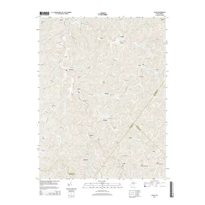
2014 Map of Chloe
USGS Topo · Published 2014About this map
The West Fork Little Kanawha River carves a complex path through the heart of Calhoun County, defining the settlement patterns of this central West Virginia landscape. Small communities like Chloe, Minnora, and Nebo are situated along the winding valley floors, connected by a network of rural routes such as WV-16. The topography is marked by distinctive high points like Mule Knob and deep drainages including Bear Run and Stinson Creek. This area is particularly dense with family and community burial grounds, offering significant value for genealogical research. Numerous sites such as the Chenowith Reip Cem, Bailey Siers Cem, and the Mollohan/Cooper Cem are meticulously plotted across the ridges and hollows, reflecting generations of local history near the boundaries of Clay, Roane, and Braxton counties.
Find a feature on this map
111 named features on this map. Tap any name to fly to it.
Don’t see what you’re looking for? This feature index may not catch every label — zoom into the map to look around manually.
Map Details
Editions of this 2014 Chloe Map
This is the sole edition of this map. No revisions or reprints were ever made.
Other maps of this area

1893 · Sutton
USGS Topo · 1:125,000

1906 · Glenville
USGS Topo · 1:62,500

1906 · Otter
USGS Topo · 1:62,500

1907 · Otter
USGS Topo · 1:62,500

1907 · Arnoldsburg
USGS Topo · 1:62,500

1908 · Gassaway
USGS Topo · 1:48,000

1910 · Gassaway
USGS Topo · 1:62,500

1925 · Glenville
USGS Topo · 1:62,500

1925 · Arnoldsburg
USGS Topo · 1:62,500

1927 · Arnoldsburg
USGS Topo · 1:62,500