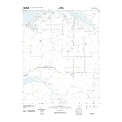
2010 Map of Chloeta
USGS Topo · Published 2010About this map
The Neosho River and its intricate shoreline dominate the northern landscape of this Delaware County region, where the water's edge is marked by a series of named inlets including Ghost Hollow, Lawhead Hollow, and Grays Hollow. To the south, the terrain transitions into a grid of rural roads supporting agricultural and residential life near the Spavinaw Creek drainage. Significant local landmarks such as the Disney Airport and the Eucha Dam illustrate the area's infrastructure and its relationship with the water systems of northeastern Oklahoma.
Find a feature on this map
51 named features on this map. Tap any name to fly to it.
Don’t see what you’re looking for? This feature index may not catch every label — zoom into the map to look around manually.
Map Details
Editions of this 2010 Chloeta Map
This is the sole edition of this map. No revisions or reprints were ever made.
Other maps of this area

1896 · Pryor
USGS Topo · 1:125,000

1899 · Siloam Springs
USGS Topo · 1:125,000

1901 · Vinita
USGS Topo · 1:125,000

1901 · Pryor
USGS Topo · 1:125,000

1903 · Siloam Springs
USGS Topo · 1:125,000

1904 · Siloam Springs
USGS Topo · 1:125,000

1907 · Wyandotte
USGS Topo · 1:125,000

1909 · Wyandotte
USGS Topo · 1:125,000

1913 · Vinita
USGS Topo · 1:125,000

1954 · Tulsa
USGS Topo · 1:250,000